Fronts
Air masses generally do not mix. The place where two air masses meet is called a front. Fronts are places where weather changes rapidly. Fronts separate air masses of different densities. There are three basic types of fronts:
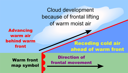
Warm Front

- Forms where a warm air mass pushes up and over a cold air mass.
- As the warm air rises, it gets cooler.
- As the air gets cooler, it releases water in the form of precipitation. Steady rain may result.
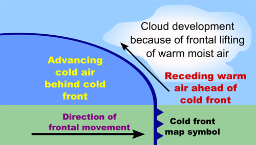
Cold Front

- Forms along the leading edge of a cold air mass advancing against a warmer air mass.
- The cold air pushes against and under the warmer air.
- This forces the warm air up rapidly.
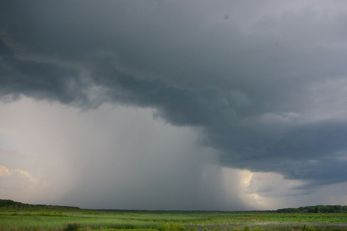
- This results in turbulence in the air, heavy precipitation, and sudden thunderstorms.
Stationary Front

- Forms when a cold air mass and a warm air mass meet, and neither has enough force to move the other.
- These can last for days until another air mass comes along with enough force to move the stalled fronts.
- Will produce lots of clouds and prolonged precipitation.